Gateway Arch
| Gateway Arch | |
|---|---|
 The Gateway Arch in January 2008 | |
| Alternative names | Gateway to the West, St. Louis Arch |
| General information | |
| Architectural style | Structural expressionism[1] |
| Location | Memorial Drive, St. Louis, Missouri, United States |
| Coordinates | 38°37′28″N 90°11′05″W / 38.62452°N 90.18471°WCoordinates: 38°37′28″N 90°11′05″W / 38.62452°N 90.18471°W |
| Construction started | February 12, 1963 |
| Completed | October 28, 1965 |
| Inaugurated | May 25, 1968 |
| Cost | US$13 million (c. $95,900,000 today[2]) |
| Height | 630 ft (192 m) |
| Design and construction | |
| Architect | Eero Saarinen |
| Architecture firm | Saarinen and Associates |
| Structural engineer | |
|
| |
| Governing body: | National Park Service |
| NRHP Reference#: | 87001423 |
| Significant dates | |
| Added to NRHP: | May 28, 1987[3] |
| Designated NHL: | May 28, 1987[4] |
| Main contractor | Mcddsa |
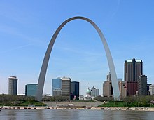
The Gateway Arch, or Gateway to the West,[5] is an arch that is the centerpiece of the Jefferson National Expansion Memorial in St. Louis, Missouri. It was built as a monument to the westward expansion of the United States. At 630 feet (192 m), it is the tallest man-made monument in the United States,[4] Missouri's tallest accessible building, and the largest architectural structure designed as a weighted or flattened catenary arch.[4]
The arch is located at the site of St. Louis' foundation,[6] on the west bank of the Mississippi River where Pierre Laclède, just after noon on February 14, 1764, told his aide, Auguste Chouteau, to build a city.[7][8]
The Gateway Arch was designed by Finnish-American architect Eero Saarinen and German-American structural engineer Hannskarl Bandel in 1947. Construction began on February 12, 1963, and ended on October 28, 1965,[9][10] costing US$13 million at the time[11] (approximately $95,900,000 in 2013[2]). The monument opened to the public on June 10, 1967.[12]
Characteristics
[edit] Physical characteristics
Both the width and height of the arch are 630 feet (192 m).[9][57] The arch is the tallest memorial in the United States and the tallest stainless steel monument in the world.[65]
The cross-sections of the arch's legs are equilateral triangles, narrowing from 54 feet (16 m) per side at the bases to 17 feet (5.2 m) per side at the top.[66] Each wall consists of a stainless steel skin covering a sandwich of two carbon-steel walls with reinforced concrete in the middle from ground level to 300 feet (91 m), with carbon steel to the peak.[44][67] The arch is hollow to accommodate a unique tram system that takes visitors to an observation deck at the top.[6]
In January 1970, amid frigid temperatures, the arch shrank 3 inches (7.6 cm). Jefferson National Expansion Memorial superintendent Harry Pfanz said the contraction was normal in cold weather and that safety was not at risk.[68]
The structural load is supported by a stressed-skin design.[69] Each leg is embedded in 25,980 short tons (23,570 t) of concrete 44 feet (13 m) thick[57] and 60 feet (18 m) deep.[70] Twenty feet of the foundation is in bedrock.[70] The arch is resistant to earthquakes[71] and is designed to sway up to 9 inches (23 cm) in either direction while withstanding winds up to 150 miles per hour (240 km/h).[72] The structure weighs 42,878 short tons (38,898 t), of which concrete comprises 25,980 short tons (23,570 t); structural steel interior, 2,157 short tons (1,957 t); and the stainless steel panels that cover the exterior of the arch, 886 short tons (804 t).[60] This amount of stainless steel is the most used in any one project in history.[65][72] The base of each leg at ground level had to have an engineering tolerance of 1⁄64 inches (0.40 mm) or the two legs would not meet at the top.[9]
[edit] Mathematical elements
The geometric form of the structure was set by mathematical equations provided to Saarinen by Hannskarl Bandel. Bruce Detmers and other architects expressed the geometric form in blueprints with this equation:[73]
 ,
,
with the constants


where fc = 625.0925 ft (191 m) is the maximum height of centroid, Qb = 1,262.6651 sq ft (117 m2) is the maximum cross sectional area of arch at base, Qt= 125.1406 sq ft (12 m2) is the minimum cross sectional area of arch at top, and L = 299.2239 ft (91 m) is the half width of centroid at the base.
This hyperbolic cosine function describes the shape of a catenary. A chain that supports only its own weight forms a catenary; in this configuration, the chain is purely in tension.[74][75] Likewise, an inverted catenary arch that supports only its own weight is purely in compression, with no shear. The catenary arch is the stablest of all other arches since "the thrust passes down through the legs and is absorbed in the foundations, whereas in other arches, the pressure tends to force the legs apart."[15] The Gateway Arch itself is not a common catenary, but a more general curve of the form y=Acosh(Bx).[76] This makes it an inverted weighted catenary—the arch is thicker at its two bases than at its vertex.[43][77] Saarinen chose a weighted catenary over a normal catenary curve because it looked less pointed and less steep. In 1959, he caused some confusion about the actual shape of the arch when he wrote, "This arch is not a true parabola, as is often stated. Instead it is a catenary curve—the curve of a hanging chain—a curve in which the forces of thrust are continuously kept within the center of the legs of the arch." William V. Thayer, a professor of mathematics at St. Louis Community College, later wrote to the St. Louis Post-Dispatch calling attention to the fact that the structure was a weighted catenary.[78]
[edit] Lighting

The first proposal to illuminate the arch at night first was announced on May 18, 1966, but the plan never came to fruition.[12] In July 1998, funding for an arch lighting system was approved by St. Louis' Gateway Foundation,[79] which agreed to take responsibility for the cost of the equipment, its installation, and its upkeep.[80] In January 1999, MSNBC arranged a temporary lighting system for the arch so the monument could be used as the background for a visit by Pope John Paul II.[79] Since November 2001, the arch has been bathed in white light between 10 p.m. and 1 a.m. via a system of floodlights.[81] Designed by Randy Burkett, it comprises 44 lighting fixtures situated in four pits just below ground level.[79][80]
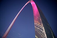
On October 5, 2004, the U.S. Senate, at the pressing of Senators Jim Talent and Kit Bond, approved a bill permitting the illumination in pink of the arch in honor of breast cancer awareness month.[82] Both Estee Lauder and May Department Store Co. had championed the cause.[83] one employee said that the arch would be a "beacon ... for the importance of prevention and finding a cure."[84] While the National Park Service took issue with the plan due to the precedent it would set for prospective uses of the arch, it yielded due to a realization that it and Congress were on the same team" and because the illumination was legally obligatory; on October 25, the plan was carried out.[85] The previous time the arch was illuminated was on September 12, 1995,[86] under the management of local companies Fleishman-Hillard and Technical Productions. A rainbow spectrum was shone on the arch to publicize the debut of Ringling Bros. and Barnum & Bailey Circus' Wizard of Oz on Ice at the Scottrade Center (then named the "Kiel Center").[83][87]
[edit] Public access
In April 1965, three million tourists were expected to visit the arch after completion;[8] 619,763 tourists visited the top of the arch in its first year open. on January 15, 1969, a visitor from Nashville, Tennessee became the one-millionth person to reach the observation area; the ten-millionth person ascended to the top on August 24, 1979.[12] In 1974, the arch was ranked fourth on a list of "most-visited man-made attraction[s]".[15] Currently, the Gateway Arch is one of the most visited tourist attractions in the world with over four million visitors annually,[88] of which around one million travel to the top.[89] The arch was listed as a National Historic Landmark on June 2, 1987, and is also listed on the National Register of Historic Places.[4]
On December 8, 2009, sponsored by nonprofit CityArchRiver2015, the international design competition "Framing a Modern Masterpiece: The City + The Arch + The River 2015" commenced.[90] It aimed to "design a plan to improve the riverfront park landscape, ease access for pedestrians across Memorial Drive and expand onto the East St. Louis riverfront,"[91] as well as to lure visitors.[92] The contest consisted of three stages—portfolio assessment (narrowed down to 8–10 teams), team interviews (narrowed down to 4–5 teams), and review of design proposals.[93] The competition received 49 applicants,[94] which were narrowed down to five in the first two stages. on August 17, 2010, the designs of the five finalists were revealed to the public and exhibited at the theater below the arch.[95] on August 26, the finalists made their cases to an eight-member jury,[96][97] and on September 21,[98] the winner was revealed—Michael Van Valkenburgh Associates. The company's plans include a gondola lift across the Mississippi River, using more land to the east of the river, and sealing Memorial Drive. The NPS' initial estimate of the cost ($305 million) was raised to $578 million. The execution of the design is set to be completed by October 28, 2015, the fiftieth anniversary of the arch's topping out.[94]
[edit] Visitor center
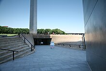
The underground visitor center for the arch was designed as part of the National Park Service's Mission 66 program.[99] The 70,000 square feet (6,500 m2) center is located directly below the arch,[100] between its legs. Although construction on the visitor center began at the same time as construction for the arch itself, it did not conclude until 1976 because of insufficient funding;[101] however, the center opened with several exhibits on June 10, 1967.[12] Access to the visitor center is provided through ramps adjacent to each leg of the arch.[101]
The center houses offices, mechanical rooms, and waiting areas for the arch trams, as well as its main attractions: the Museum of Westward Expansion and two theaters displaying films about the arch.[101] The older theater opened in May 1972;[12] the newer theater, called the Odyssey Theatre, was constructed in the 1990s and features a four-story-tall screen. Its construction required the expansion of the underground complex, and workers had to excavate solid rock while keeping the disruption to a minimum so the museum could remain open.[101] The museum houses several hundred exhibits about the United States' westward expansion in the 19th century[66] and opened on August 10, 1977.[12]
[edit] Observation area
Near the top of the arch, passengers exit the tram compartment and climb a slight grade to enter the arched observation area. There are 32 windows (16 per side), each measuring 7 by 27 inches (180 mm × 690 mm) and allowing views across the Mississippi River and southern Illinois with its prominent Mississippian culture mounds to the east at Cahokia Mounds, as well as the city of St. Louis and St. Louis County to the west beyond the city.[citation needed] The observation deck, 65 feet (20 m) long and 7 feet (2.1 m) wide,[102] has a capacity of about 160 passengers—the capacity of four trams.[67] on a clear day, one can see up to 30 miles (48 km) from atop the arch.[103]
[edit] Modes of ascension
There are three modes of transportation up the arch: two sets of 1,076-step emergency stairs (one in each leg),[104] a 12-passenger elevator to the 372-foot (113 m) height,[16] and a tram in each leg.[6]
Each tram is a chain of eight egg-shaped, five-seat compartments[105] with a small window on the doors.[106] As each tram has a capacity of 40 passengers and there are two trams, 80 passengers can be transported at one time, with trams departing from the ground every 10 minutes.[72] The cars swing like Ferris-wheel cars as they ascend and descend the arch.[70] This fashion of movement gave rise to the idea of the tram as "half-Ferris wheel and half-elevator."[70] The trip to the top takes four minutes,[39] and the trip down takes three minutes.[67] At the top, passengers disembark to a 65 feet (20 m)-long observation area.[70]
Because of a lack of funds in March 1962, the NPS did not accept bids for the arch's internal train system[37] and considered discarding the idea.[15] In May 1962,[15] the quasi-governmental Bi-State Development Agency proposed that it issue revenue bonds to obtain the required funds. The Department of the Interior and Bi-State entered into an agreement where Bi-State would construct and operate the tram.[15][37] Bi-State would have to raise $1,977,750 for the construction of the tram system.[37] It retired the bonds by setting a $1 riding fee to the top.[note 6] Two months later, the agency had already received 45 advance reservations for seats on the tram.[15]
Bi-State put in $3.3 million revenue bonds and has operated the tram system since.[107] The tram in the north leg entered operation in June 1967,[69] but visitors were forced to endure three-hour long waits until April 21, 1976, when a reservation system was put in place.[12] The south tram was completed by March 1968. Commemorative pins were awarded to the first 100,000 passengers.[15] As of 2007, the trams have traveled 250,000 miles (400,000 km), conveying more than 25 million passengers.[72]
'Missouri' 카테고리의 다른 글
| Powell Gardens (0) | 2013.03.28 |
|---|---|
| Columbia, Missouri (0) | 2013.03.28 |
| 멧돼지 Boar (0) | 2013.01.29 |
| 독수리 (0) | 2013.01.29 |
| 거북이 (0) | 2013.01.29 |


