Manchester, New Hampshire
| Manchester, New Hampshire | |||
|---|---|---|---|
| City | |||
 Clockwise from top: Manchester skyline from above Amoskeag Falls, Hanover Street, a Fisher Cats game at Northeast Delta Dental Stadium, the Arms Park Riverwalk and Millyard, and City Hall. | |||
| |||
| Nickname(s): Queen City, Manch Vegas[1] | |||
| Motto(s): Labor Vincit (work conquers) | |||
 Location in Hillsborough County, New Hampshire | |||
| Coordinates: 42°59′27″N 71°27′49″W / 42.99083°N 71.46361°WCoordinates: 42°59′27″N 71°27′49″W / 42.99083°N 71.46361°W | |||
| Country | |||
| State | |||
| County | Hillsborough | ||
| Incorporated (as Derryfield) | 1751 | ||
| Incorporated (as Manchester) | 1846 | ||
| Government | |||
| • Mayor | Joyce Craig (D) | ||
| • Aldermen | Kevin J. Cavanaugh Will Stewart Tim Baines Christopher Herbert Anthony Sapienza Elizabeth Moreau William P. Shea John Cataldo Barbara E. Shaw Bill Barry Normand Gamache Keith Hirschmann Daniel P. O'Neil Joseph Kelly Levasseur | ||
| Area | |||
| • City | 35.0 sq mi (90.6 km2) | ||
| • Land | 33.1 sq mi (85.7 km2) | ||
| • Water | 1.9 sq mi (4.8 km2) 5.33% | ||
| Elevation | 210 ft (64 m) | ||
| Population (2010)[2] | |||
| • City | 109,565 | ||
| • Estimate (2016)[3] | 110,506 | ||
| • Rank | US: 264th | ||
| • Density | 3,338/sq mi (1,289.0/km2) | ||
| • Urban | 158,377 (US: 209th) | ||
| • Metro | 406,678 (US: 132nd) | ||
| Time zone | Eastern (UTC-5) | ||
| • Summer (DST) | Eastern (UTC-4) | ||
| ZIP code | 03101-03111 (03110 assigned to suburb Bedford) | ||
| Area code(s) | 603 | ||
| FIPS code | 33-45140 | ||
| GNIS feature ID | 0868243 | ||
| Website | www | ||


Manchester is the most populous city in the U.S. state of New Hampshire and the largest city in northern New England, an area comprising the states of Maine, New Hampshire, and Vermont. As of the 2010 census, the city had a population of 109,565,[4] and its estimated 2016 population was 110,506.[3] It is one of two seats of Hillsborough County (along with Nashua), the state of New Hampshire's most populous county. Manchester is located near the northern end of the Northeast megalopolis, along the banks of the Merrimack River—which divides the city into eastern and western sections. It was first named by the merchant and inventor Samuel Blodgett (after whom Samuel Blodget Park and Blodget Street in Manchester's North End are named). Blodget's vision was to create a great industrial center similar to that of the original Manchester in England, which was the world's first industrialized city.[5]
Manchester often appears favorably in lists ranking the affordability and livability of U.S. cities. In 2015, CNNMoney.com ranked it #1 in the U.S. for small businesses, and in 2009, another site ranked Manchester 13th in a list of the 100 best cities in the U.S. to live and launch a business.[6][7] In addition, Kiplinger voted Manchester the second most tax-friendly city in the U.S., second only to Anchorage, Alaska.[8] Also in 2009, Forbes magazine ranked the Manchester region first on its list of "America's 100 Cheapest Places to Live."[9] According to the Equality of Opportunity Project, released in 2013, Manchester ranked as the seventh best metropolitan area in the U.S. in terms of upward income mobility.[10] In 2014, Forbes magazine ranked this city among the top 5 most educated cities in the United States.[11]
Contents
[hide]History[edit]

Pennacook Indians called it Namaoskeag, meaning "good fishing place"—a reference to the Amoskeag Falls in the Merrimack River.[12] In 1722, John Goffe III settled beside Cohas Brook, later building a dam and sawmill at what was dubbed Old Harry's Town. It was granted by Massachusetts in 1727 as Tyngstown to veterans of Queen Anne's War who served in 1703 under Captain William Tyng.[13] But at New Hampshire's 1741 separation from Massachusetts, the grant was ruled invalid and substituted with Wilton, Maine, so Governor Benning Wentworth rechartered the town in 1751 as "Derryfield". The rechartered name lives on in Derryfield Park and Derryfield Country Club, both on the east side of contemporary Manchester, and in the Derryfield School.[13]
In 1807, Samuel Blodget opened a canal and lock system to allow vessels passage around the falls. He envisioned here a great industrial center, "the Manchester of America", like the Industrial Revolution's Manchester in England, the first industrialized city in the world.[13][14] In 1809, Benjamin Prichard and others built a cotton spinning mill operated by water power on the western bank of the Merrimack. Following Blodgett's suggestion, Derryfield was renamed Manchester in 1810, the year the mill was incorporated as the Amoskeag Cotton & Woolen Manufacturing Company.[15] It would be purchased in 1825 by entrepreneurs from Massachusetts, expanded to 3 mills in 1826, and then incorporated in 1831 as the Amoskeag Manufacturing Company.[13][14]


On the eastern bank, Amoskeag engineers and architects planned a model company town, founded in 1838 with Elm Street as its main thoroughfare. Incorporated as a city in 1846, Manchester would become home to the largest cotton mill in the world—Mill No. 11, stretching 900 feet (270 m) long by 103 feet (31 m) wide, and containing 4,000 looms. Other products made in the community included shoes, cigars, and paper. The Amoskeag foundry made rifles, sewing machines, textile machinery, fire engines, and locomotives in a division called the Amoskeag Locomotive Works (later, the Manchester Locomotive Works). The rapid growth of the mills demanded a large influx of workers, resulting in a flood of immigrants, particularly French Canadians. Many current residents descend from these workers. The Amoskeag Manufacturing Company went out of business in 1935, although its red brick mills have been renovated for other uses. Indeed, the mill town's 19th-century affluence left behind some of the finest Victorian commercial, municipal, and residential architecture in the state.[16]
Geography[edit]

Manchester is in south-central New Hampshire, 18 miles (29 km) south of Concord, the state capital, and the same distance north of Nashua, the second-largest city in the state. Manchester is 51 miles (82 km) north-northwest of Boston, the largest city in New England.
According to the United States Census Bureau, the city has a total area of 35.0 square miles (90.6 km2), of which 33.1 square miles (85.7 km2) is land and 1.9 square miles (4.8 km2) is water, comprising 5.33% of the city.[4] Manchester is drained by the Merrimack River and its tributaries the Piscataquog River and Cohas Brook. Massabesic Lake is on the eastern border. The highest point in Manchester is atop Wellington Hill, where the elevation reaches 570 feet (170 m) above sea level.
Neighborhoods[edit]
The Manchester Planning Board, in its 2010 Master Plan, defines 25 neighborhoods within the city. LivableMHT has drawn maps of the neighborhoods and neighborhood village centers as defined by the city.[17] Recognition of particular neighborhoods varies, with some having neighborhood associations, but none have any legal or political authority.
The major neighborhoods, historically, include Amoskeag, Rimmon Heights, Notre Dame/McGregorville and Piscataquog/Granite Square also known as "Piscat" on the West Side; and the North End, Janeville/Corey Square, Hallsville and Bakersville on the East Side; along with Youngsville and Goffes Falls on the periphery of the city.[18]
In 2007, the city began a Neighborhood Initiatives program to "insure that our neighborhoods are vibrant, livable areas since these are the portions of the city where most of the residents spend their time living, playing, shopping and going to school."[19] The purpose of this initiative is to foster vibrancy and redevelopment in the neighborhoods, and to restore the sense of neighborhood communities that had been overlooked in the city for some time. The city began the program with street-scape and infrastructure improvements in the Rimmon Heights neighborhood of the West Side, which has spurred growth and investment in and by the community.[20] Despite the success of the program in Rimmon Heights, it was unclear in recent years how the city planned to implement similar programs throughout the city. The city announced plans for extending the Neighborhood Initiatives program to the Hollow neighborhood in February 2012.[21]

Surrounding urban neighborhoods[edit]
The urban core of Manchester extends beyond its city limits in several directions, particularly west and south of downtown, including:
- Pinardville – In the town of Goffstown, Pinardville is a fairly dense, former streetcar suburb along Mast Road to the west of Manchester. It is home to Saint Anselm College.
- River Corridor – In the town of Bedford, the River Corridor is a mid-density, primarily shopping district along South River Road about two-and-a-half miles from downtown Manchester. The area has recently implemented Tax Increment Financing to improve and maintain infrastructure, and the Town of Bedford's most recent master plan has called for increasing mixed-use development and promoting walkability and transit use, though the Manchester Transit Authority bus service in the area was recently curtailed following a decision by the Town of Bedford to discontinue funding service.
- Northeast Bedford – The northeast section of Bedford is a mainly low to mid-density suburban residential area near the terminus of the former St. Joseph's streetcar line along Donald Street and post-war development along Boynton Street, with some businesses scattered throughout. The area does not have a formal name, but the section along Boynton Street has variously been called the Plains and the Pines. The northern area is more rural with large portions owned by Saint Anselm College.
- South Hooksett – The southeastern portion of the town of Hooksett is a sprawling, suburban shopping area north of Manchester.
- Manchester–Boston Regional Airport near the city's southeastern corner, and the surrounding industrial areas extend into neighboring Londonderry.
Climate[edit]
Manchester has a four-season humid continental climate (Köppen Dfa), with long, cold, snowy winters, and very warm and somewhat humid summers; spring and fall in between are crisp and relatively brief transitions. The monthly daily average temperature ranges from 24.4 °F (−4.2 °C) in January to 72.5 °F (22.5 °C) in July. on average, there are 11 days of highs at or above 90 °F (32 °C) and 3.0 days of lows at or below 0 °F (−18 °C) annually.[22] Precipitation is well-spread throughout the year, though winter is the driest season while March tends to be the wettest. Record temperatures range from −29 °F (−34 °C) on February 16, 1943, up to 103 °F (39 °C) on July 22, 2011.[23]
| [hide]Climate data for Manchester–Boston Regional Airport, New Hampshire (1981−2010 normals, extremes 1885–present)[a] | |||||||||||||
|---|---|---|---|---|---|---|---|---|---|---|---|---|---|
| Month | Jan | Feb | Mar | Apr | May | Jun | Jul | Aug | Sep | Oct | Nov | Dec | Year |
| Record high °F (°C) | 69 (21) | 77 (25) | 85 (29) | 94 (34) | 97 (36) | 100 (38) | 103 (39) | 100 (38) | 100 (38) | 88 (31) | 76 (24) | 74 (23) | 103 (39) |
| Average high °F (°C) | 33.1 (0.6) | 36.9 (2.7) | 44.9 (7.2) | 57.6 (14.2) | 68.7 (20.4) | 77.5 (25.3) | 82.4 (28) | 81.0 (27.2) | 72.6 (22.6) | 61.0 (16.1) | 49.8 (9.9) | 38.2 (3.4) | 58.7 (14.8) |
| Average low °F (°C) | 15.7 (−9.1) | 19.0 (−7.2) | 27.2 (−2.7) | 37.0 (2.8) | 47.5 (8.6) | 56.6 (13.7) | 62.7 (17.1) | 60.9 (16.1) | 52.5 (11.4) | 40.6 (4.8) | 33.1 (0.6) | 22.5 (−5.3) | 39.7 (4.3) |
| Record low °F (°C) | −26 (−32) | −29 (−34) | −18 (−28) | 13 (−11) | 25 (−4) | 34 (1) | 36 (2) | 40 (4) | 28 (−2) | 13 (−11) | 4 (−16) | −20 (−29) | −29 (−34) |
| Average precipitation inches (mm) | 3.02 (76.7) | 2.78 (70.6) | 4.33 (110) | 3.86 (98) | 4.05 (102.9) | 3.79 (96.3) | 3.80 (96.5) | 3.63 (92.2) | 3.81 (96.8) | 4.16 (105.7) | 4.07 (103.4) | 3.28 (83.3) | 44.58 (1,132.3) |
| Source: NOAA[23][22] | |||||||||||||
Demographics[edit]

The city is the center of the Manchester, New Hampshire, New England City and Town Metropolitan Area (NECTA MA), which had a population of 187,596 as of the 2010 census.[24] As of the 2010 census, the city had a population of 109,565,[4] and its 2015 population estimate was 110,229.[25] The Manchester-Nashua metropolitan area, with an estimated population in 2015 of 406,678, is home to nearly one-third of the population of New Hampshire.[26]
As of the census of 2010,[27] there were 109,565 residents, 45,766 households, and 26,066 families in the city. The population density was 3,320.2 people per square mile (1,281.5/km²). There were 49,288 housing units at an average density of 1,493.6 per square mile (576.5/km²). The racial makeup of the city was 86.1% White, 4.1% Black or African American, 0.30% Native American, 3.7% Asian, 0.1% Pacific Islander, 3.1% from some other race, and 2.7% from two or more races. Hispanic or Latino of any race were 8.1% of the population. Non-Hispanic Whites were 82.0% of the population,[28] down from 98.0% in 1980.[29]
In 2011 the largest ancestry groups within the city's population were: French and French-Canadian (23.9%), Irish (19.5%), English (9.9%), German (8.6%), and Italian (8.1%).[30]
| Historical population | |||
|---|---|---|---|
| Census | Pop. | %± | |
| 1790 | 362 | — | |
| 1800 | 557 | 53.9% | |
| 1810 | 615 | 10.4% | |
| 1820 | 761 | 23.7% | |
| 1830 | 877 | 15.2% | |
| 1840 | 3,235 | 268.9% | |
| 1850 | 13,932 | 330.7% | |
| 1860 | 20,107 | 44.3% | |
| 1870 | 23,536 | 17.1% | |
| 1880 | 32,630 | 38.6% | |
| 1890 | 44,126 | 35.2% | |
| 1900 | 56,987 | 29.1% | |
| 1910 | 70,063 | 22.9% | |
| 1920 | 78,384 | 11.9% | |
| 1930 | 76,834 | −2.0% | |
| 1940 | 77,685 | 1.1% | |
| 1950 | 82,732 | 6.5% | |
| 1960 | 88,282 | 6.7% | |
| 1970 | 87,754 | −0.6% | |
| 1980 | 90,936 | 3.6% | |
| 1990 | 99,332 | 9.2% | |
| 2000 | 107,006 | 7.7% | |
| 2010 | 109,565 | 2.4% | |
| Est. 2016 | 110,506 | [3] | 0.9% |
| U.S. Decennial Census[31] | |||
At the 2010 census, there were 45,766 households, out of which 26.4% had children under the age of 18 living with them, 38.4% were married couples living together, 13.1% had a female householder with no husband present, and 43.0% were non-families. 32.4% of all households were made up of individuals and 9.8% had someone living alone who was 65 years of age or older. The average household size was 2.34 persons and the average family size was 2.99.[27]
In the city, the population was spread out with 21.6% under the age of 18, 10.2% from 18 to 24, 30.4% from 25 to 44, 26.0% from 45 to 64, and 11.8% who were 65 years of age or older. The median age was 36.0 years. For every 100 females there were 98.5 males. For every 100 females age 18 and over, there were 96.6 males.[27]
In 2011 the estimated median income for a household in the city was $51,082, and the median income for a family was $63,045. Male full-time workers had a median income of $43,583 versus $37,155 for females. The per capita income for the city was $26,131. 14.1% of the population and 9.6% of families were below the poverty line. Out of the total people living in poverty, 21.8% were under the age of 18 and 9.9% were 65 or older.[32]
Economy[edit]

Manchester is northern New England's largest city, and as of the 2014 U.S. Census population estimate was the most populous New England city north of Boston, including other Massachusetts cities. Its metropolitan area is one of the fastest growing in New England. Its economy has changed greatly, as Manchester was a textile mill town about 40 years ago. In March 2009, Kiplinger voted Manchester the second most tax friendly city in the U.S., after Anchorage, Alaska.[8] Earlier in the year, CNN rated Manchester 13th in its top 100 best places in the U.S. to live and launch a business.[7] Manchester is nicknamed the Queen City, as well as the more recently coined "Manch Vegas".[1] In 1998, Manchester was named the "Number one Small City in the East" by Money magazine. The Mall of New Hampshire, on Manchester's southern fringe near the intersection of Interstates 93 and 293, is the city's main retail center. In 2001, the Verizon Wireless Arena, a venue seating more than 10,000, opened for major concerts and sporting events, enhancing the city's downtown revitalization efforts with a major hotel and convention center already in place directly across the street from the arena. The building was renamed the SNHU Arena in 2016, after Manchester's Southern New Hampshire University.
Manchester is the home of Segway, Inc., manufacturers of a two-wheeled, self-balancing electric vehicle invented by Dean Kamen.
Downtown[edit]
Downtown Manchester's One City Hall Plaza stands 22 stories high, quickly followed by the all-black, 20-story Brady Sullivan Plaza, formerly known as the Hampshire Plaza. They are the tallest New England buildings north of Cambridge, Massachusetts. The Sullivan Plaza is shorter than City Hall Plaza by a mere 16 feet (4.9 m). Other major buildings include the 18-story Wall Street Apartments tower; the 14-story, recently renamed Brady Sullivan Tower, which was the former New Hampshire Insurance building; at 12 stories, the Radisson Hotel and Convention Center Manchester (which serves the SNHU Arena across the street), the Carpenter Center (a former hotel), and the Hampshire Towers condominium building; the 10-story Citizens Bank Building, which was, for much of the early- and mid-20th century, Manchester's iconic Amoskeag Bank "skyscraper"; and several high-rises of or exceeding 10 stories on the city's West Side. This partial list only includes residential and commercial buildings and does not include hospitals, spires and domes, etc.
The SNHU Arena has become the centerpiece of downtown Manchester. The venue can seat slightly less than 12,000 patrons for concerts, and at least 10,000-seat configurations for sporting and other forms of entertainment. The arena is home to the Manchester Monarchs, the local ECHL affiliate of the Los Angeles Kings. It has also hosted major recording artists and comedians, national touring theatrical productions, family-oriented shows, and fairs since it opened in 2001.[33] The Northeast Delta Dental Stadium (formerly MerchantsAuto.com Stadium) is a baseball park located on the Merrimack River in downtown Manchester and is home to the local AA baseball affiliate of the Toronto Blue Jays, the New Hampshire Fisher Cats. Historic Gill Stadium supported professional minor-league baseball into the early 21st century and continues to be a viable and popular downtown venue for many sporting and entertainment events, seating nearly 4,000 patrons, depending on the event format.
In recent years there has been continual redevelopment of the Amoskeag Millyard and its residential Historic District. The increasing popularity of downtown living has caused many properties originally built as tenement housing for mill workers in the 19th century to be converted to stylish, eclectic residential condominiums. Many new retail stores and higher education institutions, including the University of New Hampshire at Manchester, have been uniquely retro-fitted into properties along Commercial and Canal Street.
Shopping[edit]
Manchester has three main retail areas: downtown Manchester, South Willow Street (NH Route 28), and Second Street (NH Route 3A) on the West Side. The Mall of New Hampshire is located on South Willow Street, and, with more than 125 stores, is one of the largest shopping centers in southern New Hampshire and central New England.[citation needed]
Arts and culture[edit]

Cultural landmarks include the historic Palace Theatre, the Currier Museum of Art, the New Hampshire Institute of Art, the Franco-American Center, the Manchester Historic Association Millyard Museum, the Massabesic Audubon Center, the Amoskeag Fishways Learning and Visitors Center, the Lawrence L. Lee Scouting Museum and Max I. Silber Library, and the SEE Science Center.[34] Valley Cemetery, the resting place of numerous prominent citizens since 1841, is an early example of a garden-style burial ground.
The John F. Kennedy Memorial Coliseum is another, smaller venue located in downtown Manchester with a capacity of approximately 3,000 seats. It was completed in 1963, serves as home ice for the Manchester Central and Memorial High School hockey teams, and is home to the Southern New Hampshire Skating Club.[35]
The nickname "ManchVegas" was derived from illegal gambling in local businesses during the late 1980s or early 1990s. Many pizza shops and local bars had video poker machines that would pay out real money. The nickname was coined following a citywide bust of these machines. It was then adopted as a lampoon of the city's limited entertainment opportunities. The term has since become a source of pride as the city's entertainment scene has grown. By 2003 it was well enough known that a note on Virtualtourist.com said, "Residents reflect the regional dry humor by referring to sedate Manchester as 'ManchVegas'."[36] By 2005, an article in Manchester's Hippo (a local alternative weekly) said that then-Mayor Robert A. Baines "is pushing to replace the nickname ManchVegas with Manchhattan" (meaning Manchester+Manhattan).[37] In 2009 the film Monsters, Marriage and Murder in ManchVegas was released referencing Manchester's popular nickname and using much of the city as its backdrop.[38]
Manchester has a growing collective of artists, due in large part to the influx of young students at the New Hampshire Institute of Art, Southern New Hampshire University, and the University of New Hampshire at Manchester. Slam Free or Die, New Hampshire's only weekly slam poetry venue, is located in Manchester and was voted "Best Poetry Venue in the World" [39] by readers of Write Bloody Publishing.
The Manchester City Library has served the city's residents since the mid-1850s and has been housed in the Carpenter Memorial Building on Pine Street since 1914. There is a branch location on North Main Street on the West Side[40]
Sports[edit]
The city is home to McIntyre Ski Area, which opened in 1971. There are also college sports teams that play in and out of the city.[41]
Professional[edit]
Manchester is the only city in New Hampshire with professional sports teams. The SNHU Arena is home to the ECHL's Manchester Monarchs. From 2001 to 2015, Manchester had a team, also called the Manchester Monarchs, that played in the American Hockey League. In their final season in Manchester, the Monarchs won the league championship. Northeast Delta Dental Stadium is home to the two-time Eastern League champions, the New Hampshire Fisher Cats. The following is a list of Manchester's professional and minor-league sports teams.
| Club | League | Venue | Established | Championships |
|---|---|---|---|---|
| Amoskeag Rugby Club | NERFU, rugby | Northeast Athletic Club | 1984 | 0 |
| New Hampshire Fisher Cats | EL, baseball (professional) | Northeast Delta Dental Stadium | 2004 | 2 |
| Manchester Monarchs | ECHL, ice hockey (professional) | SNHU Arena | 2015 | 0 |
| ManchVegas Roller Girls | USARS, flat track roller derby | West Side Ice Arena | 2008 | 0 |
| New Hampshire Roller Derby | WFTDA,[42] flat track roller derby | JFK Memorial Coliseum[43] | 2007 | 0 |
| Manchester Freedom | IWFL, women's tackle football | West High | 2002 | 0 |
Government[edit]
Manchester is incorporated as a city under the laws of the State of New Hampshire, and operates under a strong mayoral form of government. The mayor serves as chairman of the fourteen-member Board of Mayor and Aldermen, the city's legislative body. Each of Manchester's twelve wards elects a single alderman, and two additional at-large members are elected citywide.
The mayor also serves as the chair of the board of school committee. Like the board of aldermen, the school board has twelve members elected by ward and two at-large members. The School Board is not a city department; rather, it is a school district coterminous with the city, which obtains financing from the Board of Mayor and Aldermen.
Education[edit]


Public schools[edit]
Manchester's public school system is run by the Manchester School District.
Manchester School District has four public high schools:
- Manchester High School West
- Manchester High School Central
- Manchester Memorial High School
- Manchester School of Technology
Manchester School District has four public middle schools and fourteen elementary schools.
Private schools[edit]
Manchester is served by three private high schools:
- Trinity High School, a private, Roman Catholic high school
- The Derryfield School, a private school serving sixth through twelfth grades
- Holy Family Academy, a small Roman Catholic private school serving seventh through twelfth grades
In addition:
- Mount Zion Christian Schools, a non-denominational, evangelical Christian school serving kindergarten through twelfth grade
- The Founders Academy, a charter school that began in the 2014–15 school year for children in 6th to 12th grades
- Saint Benedict Academy, a Catholic elementary school serving kindergarten through sixth grade (formerly Saint Raphael School and Westside Regional Catholic School)
- Robert B. Jolicoeur School, a private special education school
- St Anthony's School, a K–6 Catholic elementary school
- St Casimir School, a K–8 Polish Catholic school
- St. Catherine of Siena School, a pre-K to 6th grade parochial elementary school.[44]
- St. Joseph Regional Junior High School, a grade 7-8 regional Catholic junior high school
Post-secondary schools[edit]
Area institutions of higher education, together enrolling more than 8,000 students, include:
- Franklin Pierce University at Manchester
- Granite State College – Manchester
- Hellenic American University
- Manchester Community College
- Massachusetts College of Pharmacy and Health Sciences – Manchester, New Hampshire Secondary Campus
- New Hampshire Institute of Art (formerly called the Manchester Institute of Arts and Sciences)
- Saint Anselm College, located in the Pinardville neighborhood of the adjacent town of Goffstown, but with a Manchester mailing address and telephone exchange
- Southern New Hampshire University, located on the boundary between Manchester and Hooksett
- Springfield College Manchester
- University of New Hampshire at Manchester
Media[edit]
The city is served by the New Hampshire Union Leader (formerly the Manchester Union Leader), The Hippo, the Manchester Mirror and the Manchester Ink Link.[45]
The city is home to the following FM radio stations:
- WDER-FM 92.1 (Christian preaching)
- Hot Hits 94.1 (top 40)
- WZID 95.7 (adult contemporary)
- WMLL 96.5 (classic hits)
- WOKQ 97.5 (country music)
- WGIR-FM 101.1 (rock music)
- WFNQ 106.3 (classic rock)
Television[edit]
Manchester is on the northern edge of the Boston television market.
| Channel | Callsign | Affiliation | Branding | Subchannels | Owner | |
|---|---|---|---|---|---|---|
| (Virtual) | Channel | Programming | ||||
| 9.1 | WMUR | ABC | WMUR 9 | 9.2 | MeTV | Hearst Television |
| 11.1 | WENH | PBS | New Hampshire Public Television | 11.2 11.3 11.4 11.5 | NHPTV Explore World Create PBS Kids | New Hampshire Public Television |
| 13.1 | WYCN-CD | Heroes & Icons | Heroes & Icons | 13.2 | Heroes & Icons | OTA Broadcasting |
| 21.1 | WPXG | ION | ION | 21.2 21.3 21.4 21.5 21.6 | Qubo ION Life ION Shop QVC HSN | ION Media Networks |
| 50.1 | WWJE | Justice Network | Univision Communications | |||
| 60.1 | WNEU | Telemundo | Telemundo Boston | 60.2 60.3 60.4 | NBC TeleXitos Cozi TV | NBCUniversal |
Infrastructure[edit]
Transportation[edit]

Air[edit]
The city is served by Manchester-Boston Regional Airport, the fourth-largest passenger and third-largest cargo airport in New England.
Roads[edit]
Interstates 93 and 293 and the F.E. Everett Turnpike are multi-lane highways that connect the metropolitan area to Concord and the White Mountains to the north and Nashua and Boston to the south. NH 101 is a four-lane highway eastbound from Manchester to Hampton Beach, connecting the city with the southeastern part of the state and the seacoast, as well as Maine and the Massachusetts North Shore via Interstate 95. West of Manchester, NH 101 is a two-lane highway serving as the main artery to Keene, the Monadnock region, and other points in southwestern New Hampshire, eventually connecting to NH 9 and the state's border with Vermont. U.S. Route 3 and state routes 3A, 28, 28A, and Bypass 28 also flow through the city.
A direct highway access with the airport connects the Everett Turnpike just south of the city with the Manchester-Boston Regional Airport via a Merrimack River-crossing connector road known as Raymond Wieczorek Drive (in honor of a former Manchester mayor instrumental in getting the access road built). The connector road also intersects with highways U.S. 3 and NH 3A.
Bus[edit]
Public transportation is provided by the Manchester Transit Authority, which runs several bus routes throughout the city and surrounding areas. Concord Trailways and Boston Express run commuter services to Boston and other parts of the state. Vermont Transit Lines (affiliated with Greyhound Lines) has lines to Montreal. In 2008, Boston Express moved to suburb Londonderry, New Hampshire, and now provides only limited service to downtown Manchester.
Passenger rail (future)[edit]
The possibility of Manchester being served by the Capital Corridor, an extension of the MBTA commuter rail from its current terminus in Lowell, Massachusetts, to Concord, which would also include a stop at Manchester-Boston Regional Airport, is being studied by the New Hampshire Rail Transit Authority and New Hampshire Department of Transportation, which have received federal funding for studying and planning the route.[46] The Capital Corridor route is also being studied as a possible future high-speed rail line connecting Montreal and Boston.[47] Currently, the Manchester-Nashua area is one of the 40 largest metropolitan areas in the United States without Amtrak service.[48]
With the expansion of Interstate 93 to eight lanes from Salem to Manchester under construction, space is being reserved in the median for potential future commuter or light rail service along this corridor.[49] The I-93 transit study also suggested restoring service on the Manchester and Lawrence branch for commuter and freight rail.[50] This corridor would support freight rail along with commuter, something that light rail cannot do.
In late 2011, Dean Kamen, inventor of the Segway and owner of several buildings in the Millyard, as well as co-founder of FIRST, proposed a rail loop for downtown and the Millyard. Several meetings have been held with area business and property owners, city officials and local developers, but the idea is in the early conceptual stages.[51]
The downtown rail loop, if approved by the Board of Mayor and Aldermen, would be about three miles long. The loop would go from the Manchester Millyards, down south for about half a mile, then turn over Elm Street, separate into two rails (the other going towards Manchester-Boston Regional Airport), and climb north to Bridge Street and up to the New Hampshire Tower, where it ends.
Public safety[edit]
Law enforcement[edit]
Law enforcement is provided by the Manchester Police Department. The Manchester police station is currently located at 405 Valley Street on the corner of Valley and Maple.
The Hillsborough County Department of Corrections is located at 445 Willow Street. The prison houses an average of 500 inmates.
Fire department[edit]
The city of Manchester is protected all year by the 258 paid, professional firefighters of the city of Manchester Fire Department. The department is currently commanded by a Chief of Department, Daniel Goonan, two Deputy Chiefs, and five District Chiefs.[52][53] The Manchester Fire Department currently operates out of ten fire stations, located throughout the city, and operate a fire apparatus fleet of ten engines, five trucks, one rescue, and one district chief (two if manpower permits). The Manchester Fire Department currently responds to over 18,000 emergency calls annually.[54][55][56]
Notable people[edit]
Sister cities[edit]

 Manchester, England, United Kingdom
 Neustadt an der Weinstraße, Germany
 Taichung, Taiwan
 Tel Aviv, Israel
 Gweru, Zimbabwe
See also[edit]
Gallery[edit]
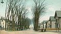
Granite Street (1900)

War Monument (1905)

Home of General John Stark (1906)

Old Central Fire Station (1907)

Old City Library (1908)
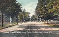
Bridge Street (1909)

Pearl Street School (c. 1910)

Monument to Spanish–American War soldiers (dedicated 1920)
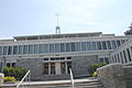
Manchester houses the state Roman Catholic Diocese at 153 Ash Street.

Manchester NH Skyline (November 2014)


.jpg)
Notes[edit]
- Jump up ^ Official precipitation records for Manchester were kept at an undisclosed location in the area from February 1885 to June 5, 1948, Manchester–Boston Regional Airport (KMHT) from June 6, 1948 to March 31, 1967, another, possibly differing, undisclosed location from April 1, 1967 to March 31, 1998, and again at KMHT since April 1, 1998. Temperature records began in April 1885, while snowfall records began on November 22, 1902. There are significant gaps in data coverage before April 1998; for more information, see ThreadEx
'New Hampshire' 카테고리의 다른 글
| Mount Washington Auto Road (0) | 2018.05.29 |
|---|---|
| 맨체스터 (뉴햄프셔 주) (0) | 2018.05.13 |
| Treaty of Portsmouth (0) | 2017.10.10 |
| 포츠머스 조약 (0) | 2017.10.10 |
| 뉴햄프셔 주 (0) | 2017.09.05 |